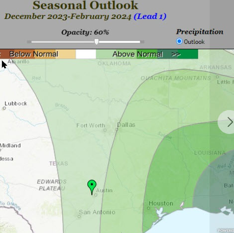
U.S. National Weather Service Austin-San Antonio Meteorologist Keith White Thursday said chances for significant rainfall in Central Texas will remain “slim” over the next several months despite an El Nino climate plan which normally increases rain chances.
White’s quarterly climate outlook presentation to the weather service’s partners can be viewed on YouTube.
Surface waters in the eastern equatorial Pacific Ocean are unusually warm during El Nino years.
Winter is one of Central Texas’ drier seasons in any year, but other modes of climate variability may limit El Nino’s impact locally, White said.
Many area locations are still in drought with two-year rainfall deficits of as much as two to three feet.
Streamflows as well as aquifers and reservoirs are unlikely to recover much until next spring at the earliest.
He said recent rains barely put a dent in the levels of Lake Medina, which is now 3 1/2% full, and Canyon Lake, which is 61% full.
Most of the questions the weather service fields daily are about precipitation, and White wishes he had better news to share.
“Unfortunately at least over the course (of the next) three months we are not expected to see nearly as much as we need to see,” he said. “We probably won’t see a cooler than normal winter but it is possible in El Nino to have warmer than normal temperatures largely due to the trend from climate change.”
In other bad news, a drier-than-normal winter and long-term drought have set Central Texas up for “pretty bad conditions in the spring in terms of fire impact.”
The good news though, is that the disastrous freeze of February 2021, the cold snap experienced in December 2022, and the significant ice storm earlier this year were “anomalous” compared to the historical record and are unlikely to be repeated.
For more information about climate change, the weather service recommends the Fifth National Climate Assessment, the U.S. government’s preeminent report on climate change impacts, risks and responses.


