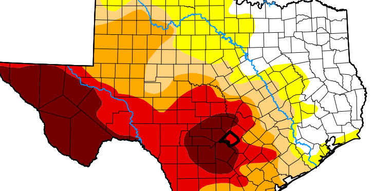
The U.S. Drought Monitor’s April 10 map remains unchanged for Comal County.
Most of the area is in the red—extreme drought—except for far west and southwestern portions of the county, which are in exceptional drought.
Tuesday, April 8, was the data cutoff for information on today’s map, which visualizes the extent and intensity of drought across the United States.
In his March Weather + Water report this week, Dr. Mark Wentzel, a hydrologist with the Texas Water Development Board (TWDB), said drought conditions are expected to improve somewhat in South Texas but expand across the Panhandle and north Central Texas over the next several months.
Near the end of March, 70% of the state was in drought, up 21 percentage points since late February.
At the end of the month, storage capacity in water supply reservoirs was about 75% of capacity, down less than a percentage point from last month, three percentage points better than last year, but still about eight percentage points below normal for this time of year, he said.