/

July 8 Lake & River Conditions for Canyon Lake

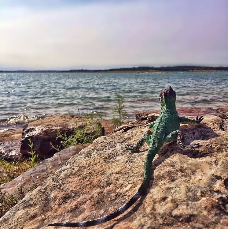
sunning lizard
We're on the ground, along with this lizard, providing real-time updates about lake and river conditions in Canyon Lake and New Braunfels, Texas.

Real-Time River Conditions

Guadalupe River @ Spring Branch

  • Streamflow: 1180 ft³/s
  • Gage height: 4.93 ft
USGS

Guadalupe River @ Sattler

  • Streamflow: 91.7 ft³/s
  • Gage height: 4.42 ft
USGS

Guadalupe River @ New Braunfels

  • Streamflow: 295 ft³/s
  • Gage height: 2.31 ft
USGS

5:32 p.m. Tuesday, July 8

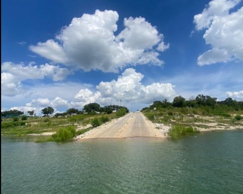
Comal County today closed all of the nine Canyon Lake boat ramps it operates around Canyon Lake. Until floodwaters entered the lake over the weekend, boat ramps were closed to motorized vessels but open for swimming, fishing and launching non-motorized vessels like kayaks or paddleboards. Today’s decision closes boat ramps completely to the public.

County ramps are: #1, 2, 5, 6, 7, 8, 11, 22, and 23.

U.S. Army Corps of Engineers ramps #10, 17, 20 and 21 are closed.

WORD of Canyon Lake extended the closure of its two lakeside parks, Comal Park on the south side of the lake and Canyon Park on the north side. The parks are tentatively scheduled to reopen on Friday.

WORD operates boat ramps #3, 4 and 18 in these parks.

Canyon Lake’s current elevation is 889.44 feet. The lake is 62.8% full.

12:24 a.m. Tuesday, July 8

Canyon Lake’s elevation is 888.95. U.S. Army Corps of Engineers/GBRA is currently releasing 72.6 cfs of water into the Lower Guadalupe @ Sattler. With floodwaters, that number bumps up to 90.1 cfs. The lake is 62.1% full.

7:55 p.m. Monday, July 7

The Guadalupe-Blanco River Authority (GBRA), which manages releases from Canyon Reservoir and sells water to downstream providers, today asked the public to avoid Canyon Lake and stay out of the Upper Guadalupe River (upstream of the lake) to avoid flood debris, fast-moving currents and bacteria levels that increase after a flood event.

Cranes Mill Marina reports water inflow has tapered off and the lake seems to be leveling out.

The marina reports debris in and around the marina and fairways. There is no known property damage.

Canyon Lake’s current elevation is 888.86 feet.

2:07 p.m. Monday, July 7

Canyon Lake is now 888.7 elevation. The Guadalupe Blanco River Authority is releasing water from Canyon Reservoir into the Lower Guadalupe River at a rate of 96 cfs or 37% of daily median capacity. U.S. Army Corps of Engineers data shows a release rate of 72.6 cfs. This does not reflect extra runoff from the recent floods. Inflow at Spring Branch is 2,410 cfs, 1898% of daily capacity.

12:40 a.m. Monday, July 7

Canyon Lake is at 888.49 feet and is 61.1% full. Comal and Canyon parks are closed through Wednesday due to debris. The public is advised to stay out of the lake. U.S. Army Corps of Engineers will meet with key stakeholders to discuss the possibility of reopening boat ramps in the near future.

The U.S. National Weather Service Austin-San Antonio has issued a flood watch in effect through Monday night. An uptick in coverage and intensity of scattered showers and storms is possible overnight near the I-35 and eastern Hill Country, developing west through the day. Excessive runoff may result in dangrous flash flooding of low-lying areas, rivers/creeks and low-water crossings.

8:00 p.m. Sunday, July 6

The National Weather Service has issued a Flash Flood Warning for Southeastern Comal County until 11:30 p.m. tonight. Areas impacted include: New Braunfels, Canyon Lake, Garden Ridge, and the surrounding southeastern parts of Comal County. There are unconfirmed reports of flooding on the Huaco Springs Loop and Elm Creek.

6 p.m. Sunday, July 6

U.S. Army Corps of Engineers Lake Manager Brett Mazey said a meeting is planned Monday between key stakeholders like WORD of Canyon Lake and Comal County Engineer Robert Boyd to discuss rising Canyon Lake levels, what to do about hazardous materials embedded in the large debris field from floodwaters, and boat ramps.

4:33 p.m. Sunday, July 6

WORD of Canyon Lake will close Canyon and Comal parks on Monday, July 7, and Tuesday, July 8, to allow time for debris in Canyon Lake to settle and for staff to conduct repair work along the shoreline. The district hopes to reopen seven days a week starting Wednesday, July 9.

4:04 p.m. Sunday, July 6

Rebecca Creek Bridge in Spring Branch is scheduled to reopen at 4 p.m. today. Canyon Lake is at 888.27 feet. GBRA has not increased the release rate from Canyon Dam. The official rate is 72.6 cfs but runoff from floods has increased that amount to 91.7 cfs.

1:06 p.m. Sunday, July 6

Canyon Lake is at 888.18 feet. It’s up by almost 11 feet and could rise another three feet this week. However, rain is still in the forecast today. The lake is 60.7% full. Canyon Lake is full of debris from floodwaters. Exercise extreme caution if out on the lake. A flood watch remains in effect until 7 p.m. Additional rainfall amounts of two to four inches are possible, with isolated pockets of 10 inches. Excessive runoff could result in dangerous flash flooding of low-lying areas. Much of the Canyon Lake area is under a boil wateer notice. Comal and Canyon parks are free and open to the public today for sightseers. USACE says North Park and Potters Creek are in good condition but asks the public to stay out of the water. Potters Creek is under a boil notice. The lake is debris-filled. Exercise extreme caution. All boat ramps are closed. The only way to launch a motorized vessel is at Canyon Lake Marina, which is closed to the public. There is a debris field affecting Cranes Mill Marina.

9:36 p.m. Saturday: U.S. Army Corps of Engineers Canyon Lake is experiencing an equipment malfunction and the official elevation data, 883.8 feet, is incorrect. The Corps is currently releasing water from Canyon Reservoir at a rate of 72.6 cfs. If you factor in water from recent floods, the release rate rises to 106 cfs. The evacuation order for River Road along the Guadalupe River below Canyon Lake is lifted. Floodwaters have created a very large debris field in Canyon Lake. Exercise caution. The Rebecca Creek bridge in Spring Branch is closed until further notice.

2:20 p.m. Saturday: Due to heavy rains the Comal River is temporarily closed for recreation by order of the Chief of Police. Guadalupe River access at River Acres Park and Cypress Bend also is closed.

12:51 p.m. Saturday: Canyon Lake’s current elevation is 883.74 feet. Lake levels have risen by around six feet. The Guadalupe River @ Sattler is at 5.43 feet. as of 1:12 p.m. It was at 4.3 feet at 9 a.m. Friday. There is a large debris field in Canyon Lake. River Road between Canyon Lake and Gruene is under evacuation orders. How high will the Guadalupe River at Spring Branch and Sattler rise today? Comal County has a website for that.

10:30 a.m. Saturday: Canyon Lake’s current elevation is 881.52 feet.

Canyon Lake’s current elevation is 877.91 feet. The normal elevation is 909 feet. The lake is 46.3% full. The U.S. Army Corps of Engineers is releasing water from Canyon Reservoir into the Lower Guadalupe River at a rate of 72.6 cfs.

To see lake levels in realtime, click here. At noon Friday, Juy 4, the Guadalupe-Blanco River Authority said no flood-control releases are expected. Flow rates along the Guadalupe River @Sattler will remain constant.

MyCanyonLake.com does not update lake levels in realtime. However, information about flow rates along the Guadalupe are current.

For streamflow data on the Comal River click here.

Release and Flow Rates

Visit the Water-Oriented Recreation District of Comal County (WORD)’s website, wordcc.com, to better understand how release rates work and their impact on flow rates in the lower Guadalupe.

For detailed information about Canyon Reservoir, visit this page by the Guadalupe-Blanco River Authority.

Guadalupe River Threshold Flow Status

  • Up to 500 cfs   Recreational
  • 500 – 750 cfs   Challenging
  • 750 – 1000 cfs   Strenuous
  • 1000 – 3000 cfs   Extreme Caution; Tubing Not Recommended
  • 3000+ cfs   Dangerous; Guided Rafts Suggested

Comal River Threshold Flow Status:

  • 100 – 500 cfs Recreational flow- safe for all activities – tubing open for all levels of swimmers
  • 500 – 1000 cfs Use extreme caution – all activities questionable – flows of this magnitude are usually caused by rainfall and involve turbid water and floating debris – contact river outfitters for more information
  • 1000 cfs River Closed

‘Flash-Flood Alley’

        During periods of heavy rain, flow rates of both the Guadalupe and Comal rivers can change rapidly and become dangerous. Central Texas is known as “flash-flood alley.” Take rain events in Canyon Lake and New Braunfels seriously.

        Closure of the Comal River inside New Braunfels city limits will be posted on the New Braunfels Police Facebook page.

        Please review our commenting rules before submitting a post.

        23 Comments

        1. A group of teens will be at Canyon Lake today. Are the conditions of the water safe, being that it rained ?

          • Hi Victoria, we suggest that you contact Texas Parks and Wildlife Department or call the US Army Corps of Engineers’ Canyon Lake office. Also, the Water Oriented District of Comal County operates Comal and Canyon parks, they would be another good source of information.

        2. Hmmmm, I guess that the GBRA selling and draining over 90,000 acre feet (1/4 of the lake’s capacity) every year has anything to do with the low level of the lake. Nah.

        3. At what level of the lake will the fresh water pumps, used to provide drinking water, be inoperable?

          Are you still planning to draw down the level of the lake in 2026 for maintenance of the pumps?

          • Was wondering the same thing. How low does it have to get before they stop drawing water for residential use?

          • I have the same question. Also, would the Corps discontinue release to river to build lake back up after repairs?

        4. Was wondering the same thing. How low does it have to get before they stop drawing water for residential use?

        5. At 46% how long will the Corps be able to continue to release water at 60 cfm before the outlet goes dry? From video I’ve seen the penstock is in some pretty shallow water. No more feed water into the lower Guadeloupe is going to get some people’s attention.

        6. Wow, 1 foot in 64 feet out, put it in the lake and shake it all about. You dry up the reservoir and try not to pout.
          That’s what selling the water is all about.

        7. Thanks for sharing this information 🙏 and all your hard work to keep everyone safe during this storm period. Praying for everyone involved in the Hill County my condolences for those lives lost.

        8. Can anyone explain why if the lake is only half full why they are releasing water after the flooding? I would think they would just let the flood water fill as much of the lake as possible. I’m not an engineer so I’m trying to understand.

        Leave a Reply

        Your email address will not be published.