Image courtesy of the U.S. National Weather Service Austin-San Antonio.
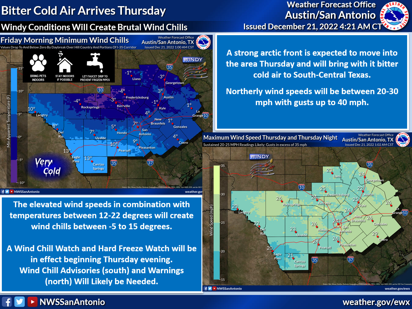
An arctic airmass will arrive Thursday during the day, bringing gusty winds, temperatures in the low teens, and wind chills in the single digits to below zero to the Canyon Lake area.
The U.S. National Weather Service Austin-San Antonio also warns of hard freezes Friday through Sunday.
Wind chill and hard freeze watches will be in effect beginning Thursday evening. Wind chill advisories (south) and warnings (north) are likely.
Northerly wind speeds between 20-30 mph are expected with gusts as high as 40 mph from late Thursday afternoon through early Friday morning.
Elevated wind speeds in combination with temperatures between 12-22 degrees will create wind chills between -5 to 15 degrees.
Today will be seasonably cool.
Warming temperatures heading into and through the beginning of next week “is the light at the end of the tunnel,” the weather service said on Facebook.