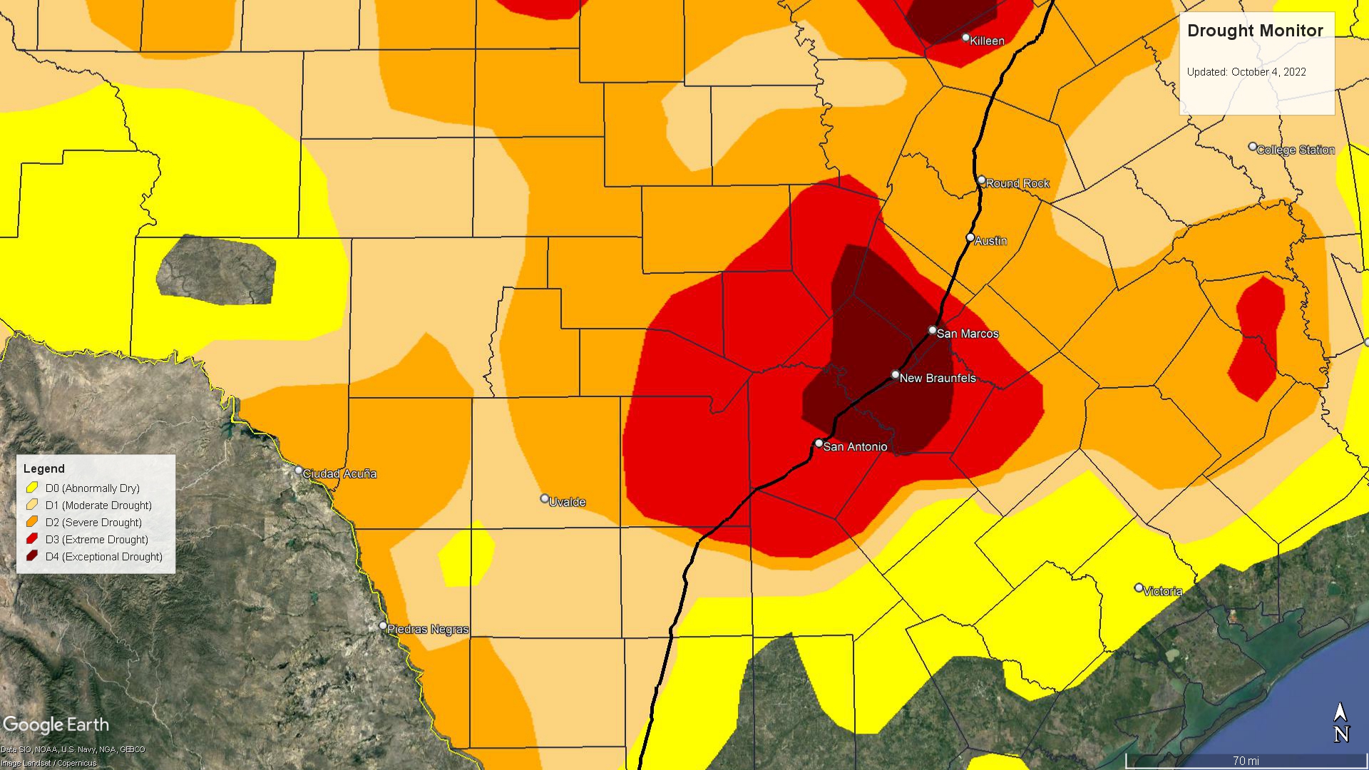
The U.S. National Weather Service Austin-San Antonio (NWS) today released a map showing the latest drought conditions across south central Texas, and Canyon Lake and the New Braunfels area are smack dab in the middle of a maroon-colored bullseye.
“Over the last month, improvement has been noted across portions of the Hill Country, southern Edwards Plateau and Rio Grande plains,” NWS said. “However, severe to exceptional drought persists along Interstate 35.”
The weather service said the region is experiencing an usual dry stretch for this time of year. Looking at monthly normal precipitation, September and October are typically wet months for the Canyon Lake area.
Isolated rain chances are possible Monday over the southern Edwards Plateau but rain-free conditions exist elsewhere. Humidity levels are expected to rise gradually into midweek.
In a South Central Drought Briefing on Wednesday, NWS said long-term outlooks favor drought expansion/degradation over the next months.
Reservoirs and aquifers still have a lot of room for recovery. Outlooks for fall into winter months indicate a likelihood of warmer-than-normal conditions, with La Nina likely to remain in place through winter.
Fire weather concerns also will return, and agricultural/rangeland interests should prepare for potential drought impacts through winter.
However…the Climate Prediction Center outlook leans wetter than normal for March, April and May of 2023.