Comal County commissioners are expected to extend the current burn ban for another 90 days at their weekly meeting Thursday.
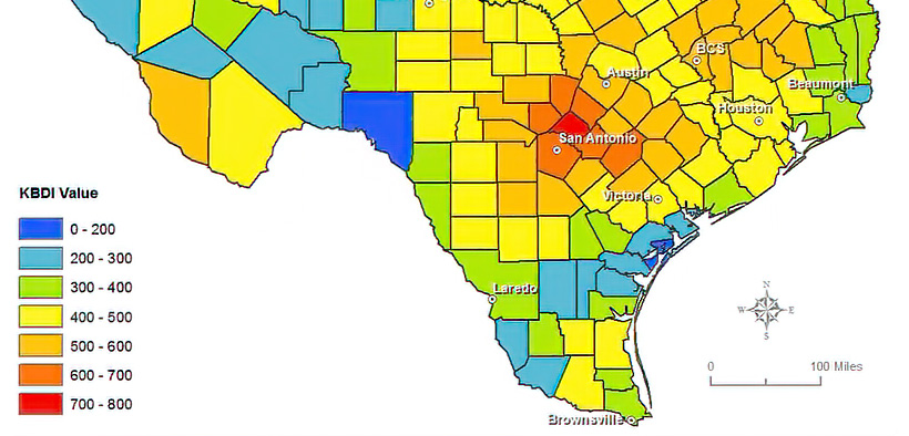
Comal is the only mostly red county on today’s Keetch-Byram Drought Index (KBDI) map, created by Texas A&M AgriLife.
KBDI measures drought. Comal County’s index today is 703.
The burn ban normally goes into effect when the KBDI reaches 500.
Fire Marshal Kory Klabunde said it will take four to six inches of rain, countywide, to get the KBDI down.
Fire pits, burn barrels, chimineas and any other outdoor fire are prohibited during the burn ban.
Only barbecue pits that are off the ground and have lids to contain sparks and flames can be used for cooking purposes only.
KBDI is used to determine forest fire potential and is an index based on a daily water balance, where a drought factor is balanced with precipitation and soil moisture.
KBDI ranges from 0 to 800, where a drought index of 0 represents no moisture depletion and an index of 800 represents absolutely dry conditions.