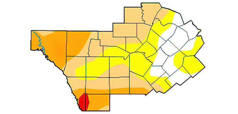
The U.S. Drought Monitor for Jan. 4 indicates conditions in Comal County are “abnormally dry.”
“Recent warmth and dryness has allowed the continued expansion and degradation of drought status for primarily western portions of south-central Texas,” the U.S. National Weather Service Austin/San Antonio said today. “Extreme Drought (D3) has returned to a portion of our area for the first time since May 2021.
John Nielsen-Gammon, a regents professor of atmospheric sciences at Texas A&M University who also serves as the state climatologist, said Texas experienced its warmest December on record since 1889.
Temperatures in Texas averaged five to nine degrees above normal, exacerbating drought conditions throughout the state. The average mean temperature for December at San Antonio International Airport was 64.2 degrees.
More than two-thirds of the state is in drought and 10% is in extreme drought.
“In much of West Texas it hasn’t rained for over two months,” Nielsen-Gammon said. “The high temperatures increase the rate of evaporation, drying out everything and leading to increased wildfire risk.”
Despite dry conditions, Comal County is not under a burn ban.
The Weather Service said some rain is in the forecast over the next seven days, which may help to mitigate drought concerns.
A chance for rain showers and isolated storms is possible from Friday night to Saturday, mainly over eastern areas.
Another cold front arrives Sunday, bringing more breezy north winds along with cooler air into early next week.