The U.S. National Weather Service Austin-San Antonio says Saharan dust remains in the forecast this weekend and is likely to create hazy conditions over the next several days.
The bad news is these dust plumes make it warmer by drying up the atmosphere, resulting in fewer clouds and less precipitation to help cool temperatures, the weather service warned on Facebook.
The good news is that hazy conditions result in vibrant sunrises and sunsets.
Saharan dust also suppresses hurricane formation and intensification.
The dust will gradually clear out by mid-week, with concentrations decreasing late on Monday.
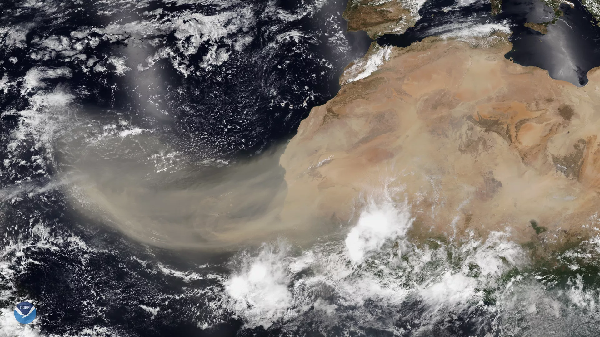
Dr. Jason Dunio, a University of Miami hurricane researcher who works with the National Oceanic and Atmospheric Administration (NOAA), said the Saharan air layer (SAL) is a mass of dry, dusty air that forms over the Sahara Desert in Africa during the late spring, summer and early fall.
“SAL activity typically ramps up in mid-June and peaks from late June to mid-August, with new outbreaks occurring every three to five days,” he said. “During this peak period itis common for individual SAL outbreaks to reach farther to the west — as far west as Florida, Central America and even Texas.”