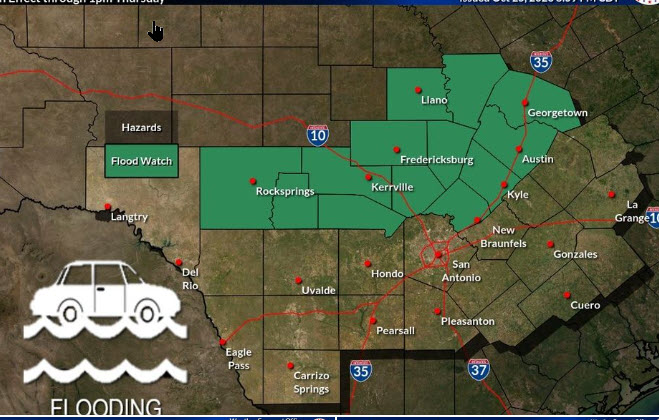
The U.S. National Weather Service Austin-San Antonio has issued a flood watch in effect through 1 p.m. Thursday for a large portion of south-central Texas including Comal, Hays, Travis and Williamson counties.
Rainfall totals of one to three inches with isolated amounts between four to six inches are possible. All of the Hill Country is at a level 3 or 4 risk for flooding, while the I-35 corridor is at a level 2 of 4 risk.
Excessive runoff from anticipated heavy rainfall may result in flooding of rivers, creeks, streams and other low-lying and flood-prone locations.
The weather service said a very moist and unstable airmass over Texas has formed due to an approaching disturbance from the west and the influx of moisture from the remnants of a tropical cyclone.
Moderate to heavy rain is expected possibly late this evening continuing into late Thursday morning.
Those living in areas prone to flooding should be prepared to take action should flooding develop.