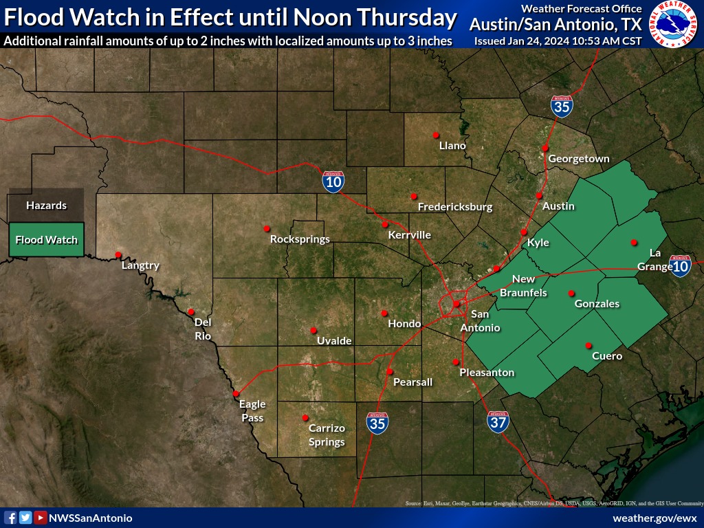
Comal County remains under a flood watch through midday Friday with another line of strong to severe storms possible later today and accumulations of two to three inches expected to fall on already saturated ground.
Localized flooding and small hail will be the main hazards. Some areas could see redeveloping fog.
As of 6 a.m. today, some three to four inches of rain was reported in the New Braunfels area with up to a foot of rain recorded in Fayette County over the last 72 hours according to the U.S. National Weather Service Austin-San Antonio.
The public is urged to avoid driving around barricades and onto flooded roadways.
Most flood fatalities occur in vehicles and even when water recedes the ground may be unstable, the weather service said. Also there is no way drivers can accurately gauge the depth of water.
Comal County Road Department crews reported eight road closures today and 10 weather-related accidents were reported according to the county.
As of 5 p.m. today the Comal County Engineer’s Office map of Comal County low water crossings showed five closures on Altgelt Lane, Hueceo Springs Loop at 940 block, Marbach Lane at Jethro, Old Bastrop Road at York Creek, and Old Nacogdoches Road at High Creek.