May is Wildfire Awareness Month, and Texas A&M Forest Service wants Texans to learn to prevent wildfires and prepare for them when they occur.
In 2024, 5,187 wildfires burned over 1.3 million acres in Texas — there were no boundaries.
“Preparation for wildfires is key to protecting both lives and property,” Erin O’Connor, the Forest Service’s public information officer, said in a statement. “During an emergency, you may only have minutes to act or evacuate. Having a plan and a go-kit can make all the difference.”
Wildlife Urban Interfaces
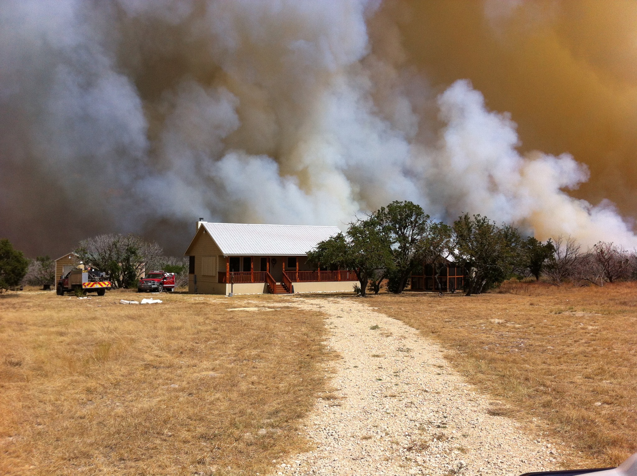
Canyon Lake is located in a wildlife urban interface area (WUI) where humans and their structures meet or mix with undeveloped wildland.
‘Communities in the WUI are at the greatest risk for wildfire damage or loss,” she said. “As Texas’ population grows and urban areas expand into more rural landscapes, the number of people that may be impacted by wildfires will increase.”
The Forest Service said communities and municipalities can create community wildfire protection plans to identify high-risk areas for WUIs and target potential fuels-reduction projects, training needs, and prevention strategies.
The agency also works with communities to create community wildfire plans, assist neighborhoods with managing the Firewise USA program, and provide risk-assessment tools.
Go-Kit
A critical component to ensuring safety and preparedness for wildfires is the preparation of a go-kit that’s easy to carry and includes supplies for several days, O’Connor said. A go-kit should include:
- Supplies for both people and pets.
- Prescription medications or other necessary medical equipment.
- Papers and important documents such as phone numbers and insurance and identification documents.
- Personal needs including food, water, clothes, money, chargers and a first aid kit.
- Priceless items such as photos, family heirlooms and any other irreplaceable or valuable items.
Evacuation Plans
O’Connor advised planning at least two evacuation routes in case the first one is blocked by heavy smoke or traffic.
Evacuation routes and shelter locations will depend on wildfire activity. Know which local emergency officials can provide official information, such as updates and instructions.
Homes and Land
O’Connor said there are many practical steps residents and landowners can take to reduce their risk from wildfire.
Residents can prepare their homes by using fire-resistant landscaping and ensuring defensible spaces are maintained.
Embers — small pieces of burning material easily carried by the wind — are the leading cause of home loss during wildfires. They can collect in small crevices around a home and enter through vents.
Simple, low-cost actions like cleaning out gutters, clearing leaves from garden beds and around structures, removing leaf piles and relocating firewood stacks at least 30 feet away from buildings can significantly reduce the risk of ember ignition.
Farms and Ranches
Landowners should assess their properties for potential hazards and make contingency plans for feeding and relocating livestock if a fire is imminent.
Fire departments should be informed about access roads, water sources, fence lines and preferred wildfire suppression tactics, O’Coonor said.