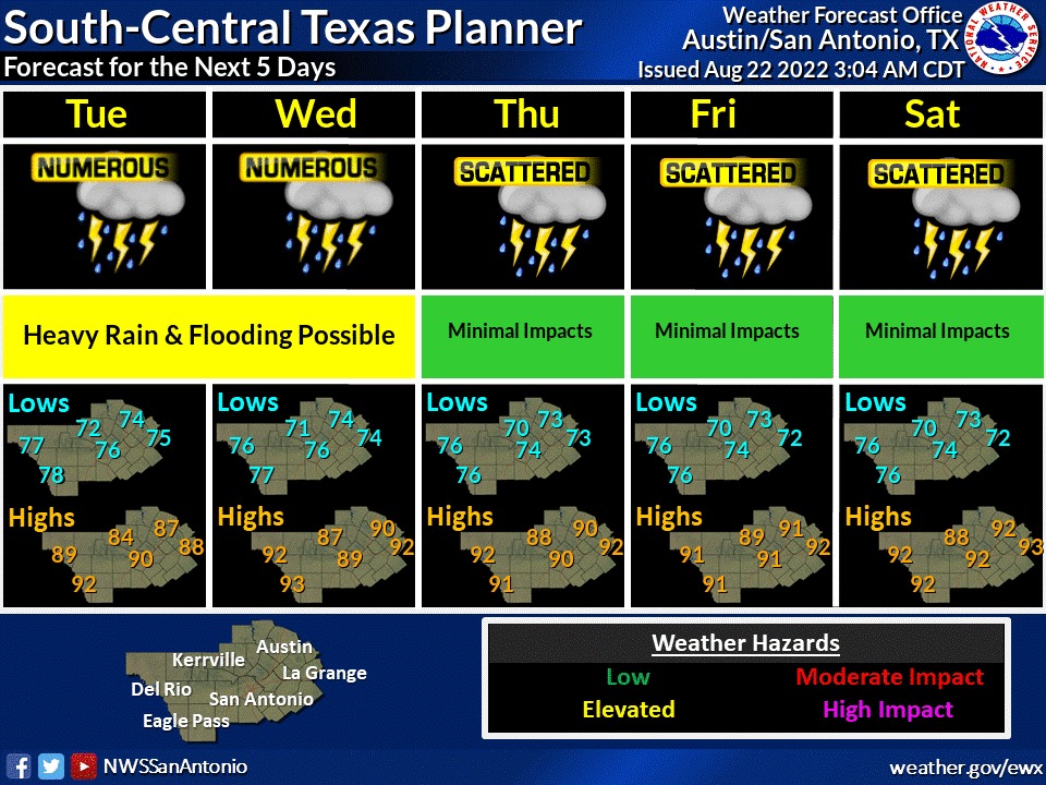
A flood watch is now in effect through Wednesday afternoon for a portion of south central Texas including Comal, Bexar and Guadalupe counties.
The U.S. National Weather Service (NWS) Austin-San Antonio says numerous showers and thunderstorms with locally heavy rains are expected to develop this afternoon and evening. Additional heavy rains are forecast for Tuesday afternoon and into Wednesday morning.
Rainfall rates of two to three inches per hour are possible.
Excessive runoff and heavy rainfall may result in the flooding of rivers, creeks and low-water crossings.
Flooding is possible at underpasses and in poor drainage and urban areas where ditches may become clogged with debris.
Rivers may rise to bankfull or into minor flooding. Excessive runoff may result in flooding of rivers, creeks, streams and other low-lying and flood-prone locations.
But NWS warns skeptics not to get complacent: “We know most of y’all have seen little rain this year, and have heard a lot of talk about storm splitting and ‘rain domes.’ It’s important that everyone understands there is no magic force field keeping you from receiving rain. If your area is under a Flood Watch, then there is potential for excessive rainfall leading to flood impacts. Yes, at your house too.”
This story was updated at 2:22 p.m.